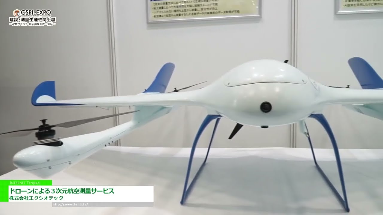
**3D Aerial Surveying Revolutionizes Accuracy with Aerosense’s Aerobowing**
CSPI-EXPO 2024: At the recent trade show, Exiotech Co., Ltd. unveiled its groundbreaking 3D aerial surveying system, Aerobowing, developed by Aerosense. Featuring RTK and LiDAR technology, Aerobowing delivers unparalleled precision in surveying ground surfaces that conventional methods struggle with.
**VTOL Drones Enhance Efficiency in Vast Areas**
Exiotech’s Aerobowing utilizes VTOL (Vertical Takeoff and Landing) fixed-wing drones to cover extensive areas rapidly. With high-speed flights of up to 50 km/h and a maximum speed of 100 km/h, these aircraft excel in inspections, patrolling, and surveying in challenging terrains such as mountains, oceans, and rivers.Generated by Gemini
website:https://www.exeo-tech.co.jp/
◇
Thinking of Exhibiting?
From exhibition video streaming to booth design & build and domestic or overseas trade shows — World Trade Show.tv is here to support you. Contact us here.